感谢 奥雅设计 对gooood的分享。更多关于:L&A Design on gooood。
Appreciation towards L&A Design for providing the following description:
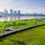
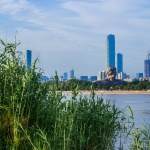
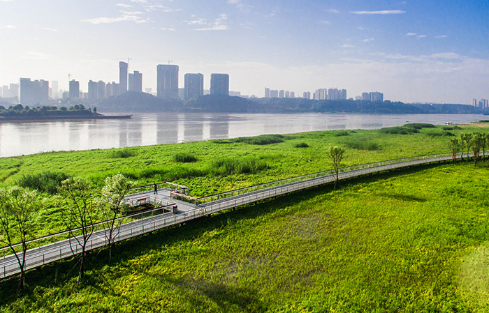
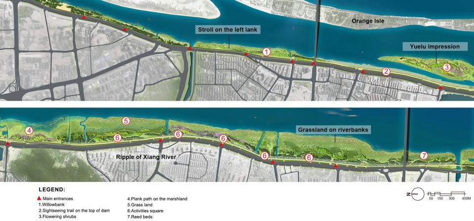
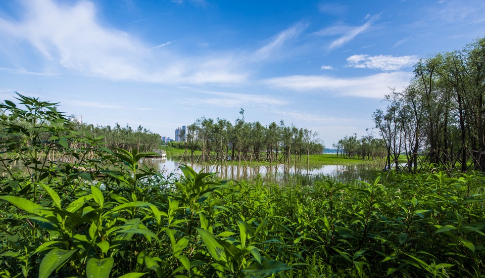
项目基地位于长沙市湘江西岸的江滩,总长度约为10公里,宽度约50到300米,总面积约为154公顷。东与橘子洲风景区隔江相望,西与岳麓山风景区遥遥相对,周边高校云集,占据绝佳的地理位置。
Located in the West Bank of Xiangjiang River in Changsha City, with a total length of about 10km, a width of about 50-300m and a total area of about 154 hectares, the project faces the Orange Isle Scenic Area on its east, the Yuelu Mountain Scenic Area in the distance on the west, and is surrounded by colleges and universities. The site is superior in the excellent geographic advantages and rich native cultural resources for further development.
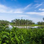
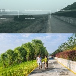
▼与橘子洲风景区隔江相望,Across the river from the Orange County Scenic Area ©林涛
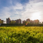
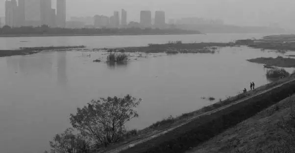
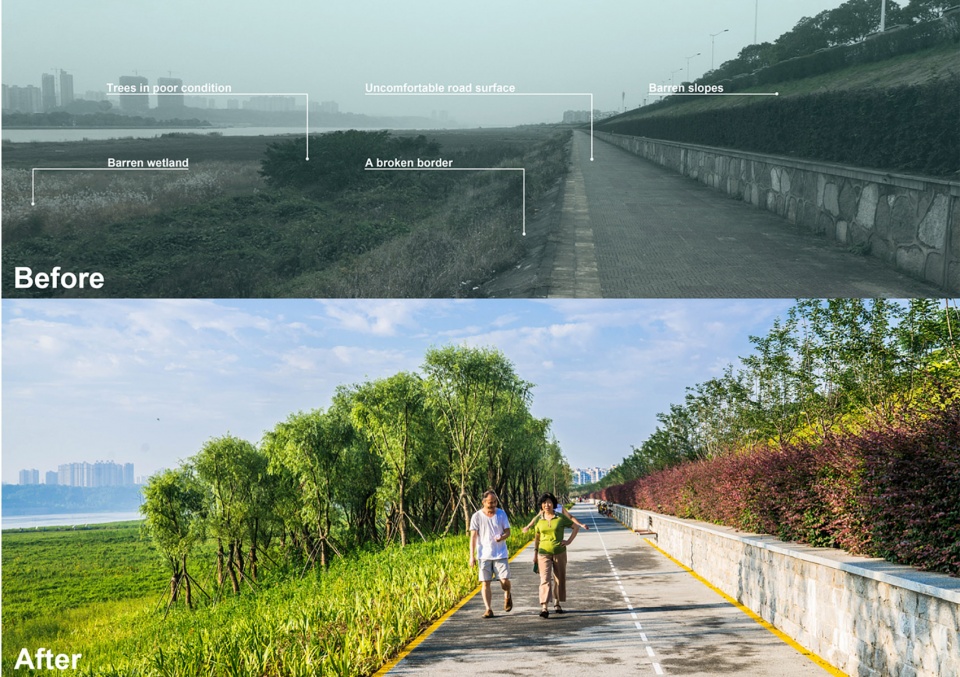
然而作为滩涂地,这里既没有呈现出生态湿地的生机盎然,也没有在雨洪过后的漫长旱季为市民提供良好的休憩娱乐的场所——生态功能与城市职能亟待开发;粗糙的人工介入使江滩与周边的山水生态产生断裂,其空间也未能与周边城市用地建立有机联系——场地孤立问题需要解决;从景观结构上看,长沙古城、橘子洲到岳麓山是长沙最重要的视线通廊,而此处的江滩是唯一的景观缺口,其破败的外观严重影响了城市观感——江滩景观急需提升。
However, as a tidal flat, the existed site did not demonstrate its ecological vibrancy of wetlands, nor provide an ideal public space for citizens to hold recreational activities during long local dry season after the rainstorm. The surrounding ecological system was damaged by rough artificial intervention and serious plastic pollution, as a result, the space was separated from the adjacent urban land. From the perspective of the city landscape structure, the most important landscape corridor in Changsha connects the old town, Orange Isle and Yuelu Mountain. Along the landscape corridor, the marshland here is the only landscape gap, where the dilapidated appearance has seriously interrupted the cityscape. Therefore, the objectives of the project were to design a friendly landscaping area to achieve ecology restoration, to build a green bridge between human and nature, and to create a cozy recreational space for local people.
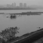
▼ 改造前的场地,The site before the renovation ©林涛
▼ 总平面图,Site plan ©奥雅设计
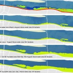
“水没旱出”是场地最大特点
Greatest Challenge of the Site
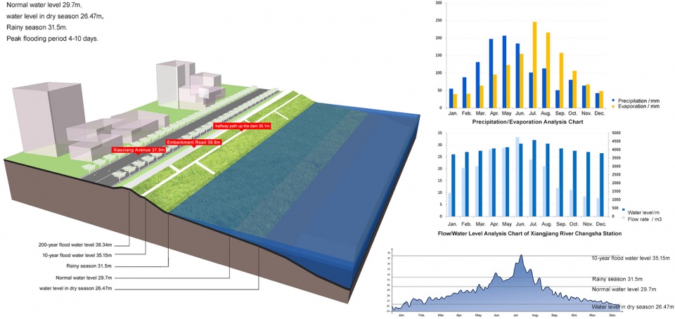
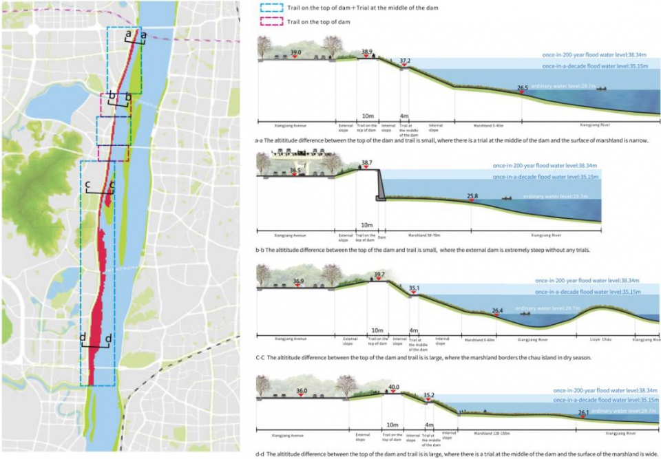
项目场地的水位变化极大,呈现年度循环的特征:每年九月至次年五月为湘江的低水位时期,这段时间江滩几乎全部露出水面,甚至有的年份场地还会出现干旱的迹象;而六、七、八三个月是湘江的丰水期,江滩则会遭受不同程度的河水侵蚀。如何在如此不稳定的现状条件下达成设计目标,是此设计的最大挑战。
There is a great variation of the water level around the project site. The marshland is totally exposed onto the water surface and even drought sometimes during the period of low water stage from annual September to May of the following year. On the contrary, the site suffers from river erosions inordinately during the flood season in annual June, July and August. Hence, it is a vital challenge to well adapt such unstable site condition to make the major goal achieved.
▼ 场地水位受到降雨量影响,Water levels on the site is affected by seasonal precipitation ©奥雅设计
基于变化的生态基底的多维度设计
Multi-dimensional Design Strategies for Such a Changeable Site
面对多变的生态基底,设计团队决定尊重江滩的自然属性和因季节而变化的水文特征,以常水位线、丰水期水位线、行洪期水位线为界限,分层次选择不同的植物策略和场地设计策略。
In accordance with such a changeable site, the design team decided to adopt multi-dimensional design strategies for various planting and site configurations leveled by normal, wet-season and flood waterlines, to well obey the existed natural and hydrological characteristics with seasonal changes.
▼不同水位高度选用不同的植物,提高江滩的物种多样性和抗性,Various plants are planted at different water levels to achieve species diversity and to strengthen flood-resistance on the marshland ©林涛
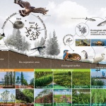
植物的多维设计助力生态修复:现状粗糙的硬质堤岸和单调的植物物种选择是造成东西方向生态通廊和南北方向生态岸线断裂的重要原因。增加植物多样性是疏通生态廊道和加强生态系统稳定性的关键。设计团队首先罗列出此物候区的抗涝耐旱植物,又从实地出发先后考察了周边湘江上的兴马洲、月亮岛、巴溪洲等环境相似的洲岛,借鉴长势良好的植物种类,筛选出垂柳、河柳、枫杨、落羽杉、池杉、乌桕、杨树作为骨干树种栽植常水位以上的区域形成风景林带。地被植物则是分为三类:出于雨季行洪的考虑,常水位以下在保持现状植物的前提下穿插种植巴茅,引导场地形成有秩序的大片茅草景观;旱涝过度区域随着地形不断抬高种植细叶芒、矮蒲苇、狼尾草、旱伞草、水生美人蕉、水生鸢尾、千屈菜、鸢尾、萱草等不同程度耐劳抗旱植物。二十年一遇的洪水位线以上的堤坡表面则是种植细叶美女樱、波斯菊、大花金鸡菊,形成高密度花丛,丰富景观。
植物群落配置搭配微地形塑造,场地为鸟类、鱼类、软体类提供了良好的栖息地,实现了物种多样性,恢复了健康的生态循环。
▼丰富的植物为鸟类、鱼类、软体类动物提供了良好的栖息地,Species diversity of plants provides ideal habitat for birds, fishes and mollusks ©奥雅设计
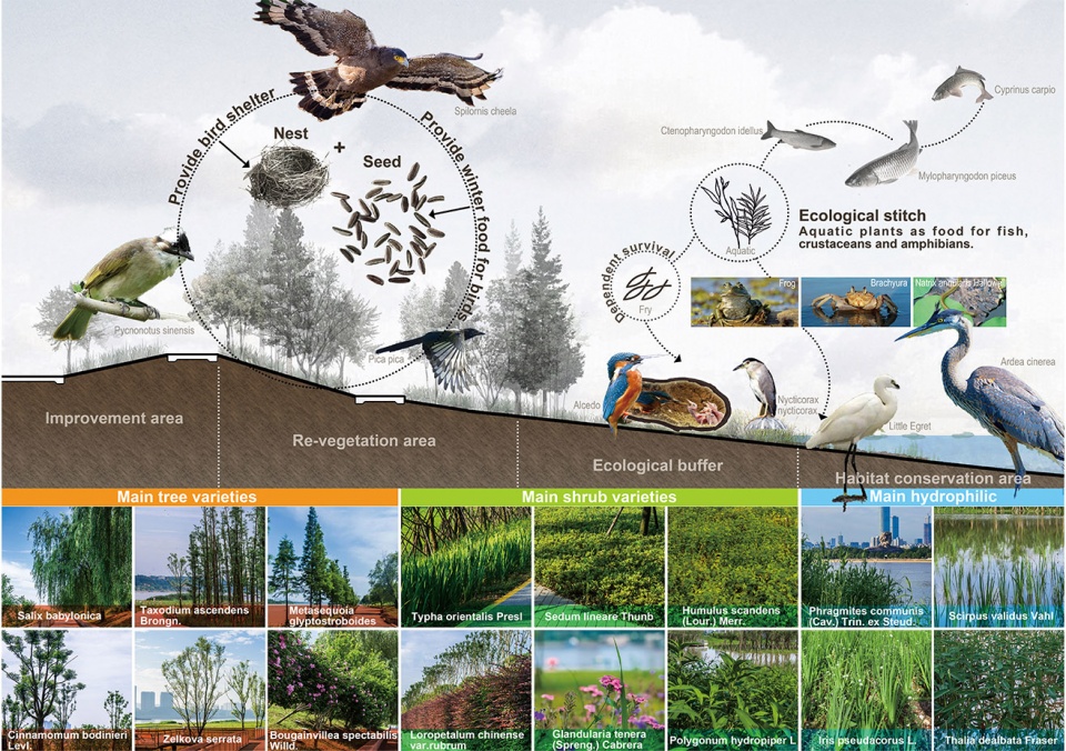
The multi-dimensional design strategy for plant configuration was helpful to promote ecological restoration: the existed rough and hard riverbank with monotonous plant species was the main block on the east-west ecological corridor and the north-south ecological shoreline. To achieve plant diversity is an important approach to unblock the ecological corridor and to strengthen the stability of ecosystems. Local drought-tolerant plants were firstly selected, and weeping willow (Salix babylonica), Chinese wingnut (Pterocarya stenoptera), bald cypress (Taxodium distichum), pond cypress (Taxodium ascendens), Chinese tallow (Triadica sebifera) and poplar (Populus) were selected as the main tree species to plant above the normal water level to create a scenic forest belt by successive on-site inspections on similar islands such as Xingma Island, Moon Island and Baxi Island along Xiangjiang River. Groundcover vegetation was planted on three different levels; considering flood discharge during the rainy season, couch grass was planted below the normal water level, for the purpose of maintaining the existing plants, to form an orderly large thatched grass landscape; drought-resistant plants, such as miscanthus, pampas grass (Cortaderia selloana), Chinese fountaingrass (Pennisetum alopecuroides), flabelliformis, Canna generalis, Water-garden Iris, purple loosestrife (Lythrum salicaria), roof iris (Iris tectorum) and orange day-lily (Hemerocallis fulva), were planted in the transitional zone in between with the changing water level; above the 20-year flood water level, Verbena tenera, garden cosmos(Cosmos bipinnatus) and large-flowered tickseed (Coreopsis grandiflora) were planted on the embankment as rich multi-dimensional planting landscape with high-density flowering scenery.
Accordingly, the healthy ecological circulation was well restored by the species diversity, providing ideal habitat for birds, fishes and molluscs with reasonable plant community configuration and micro-scale landform construction.
▼从周边自然环境中筛选适宜的植物种类作为骨干树种,Selection of suitable plant species from the surrounding natural environment as the main tree species ©林涛
▼植物种类分层设置,different species for different layers ©林涛
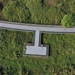
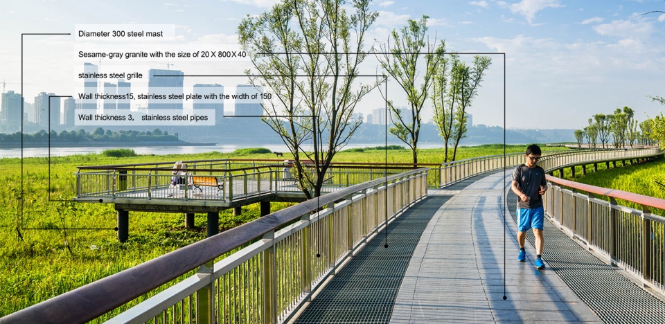
人工装置的合理选择:人工装置主要从自身加固和减少干扰两方面进行设计。在丰水期水位线以下,滩地步道采用了混凝土、钢网等耐水材料以对抗河水冲击;深入水中的栅格栈道和观景平台则选择挑高架设,为植物生长留出足够的空间,同时可保障行洪的顺利进行,从而缩短场地被浸泡的时间。
There is another key point to select suitable artificial devices which were mainly designed to strengthen the site’s self-reinforcement and minimize its interference. Below the water level in the flood season, the walking path on the marshland was built by water-resistant materials such as concrete and steel mesh to resist the impact of river water; the elevated grid planks and viewing platforms were built on the water, providing sufficient space for plant growth to form a natural flood channel, and to further shorten the time of the suffering immersed.
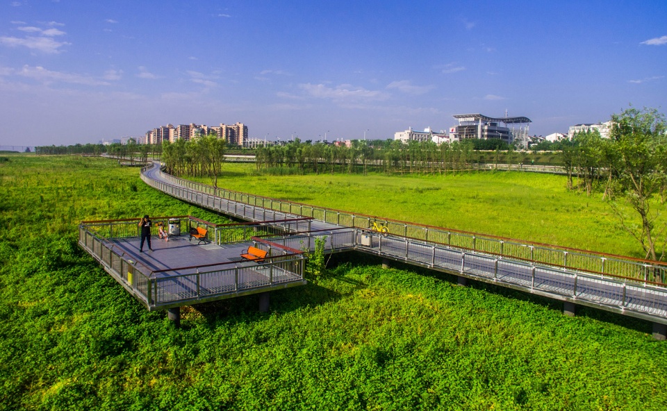
▼观景平台鸟瞰,bird-view of the platform ©石川
▼深入水中的栅格栈道和观景平台,elevated grid planks and viewing platforms ©林涛
▼滩地步道采用了混凝土、钢网等耐水材料以对抗河水冲击,The plank path extending to the marshland is constructed by water-resistant materials, such as concrete and steel mesh, to resist river water impact ©林涛
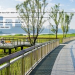
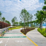
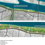
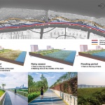
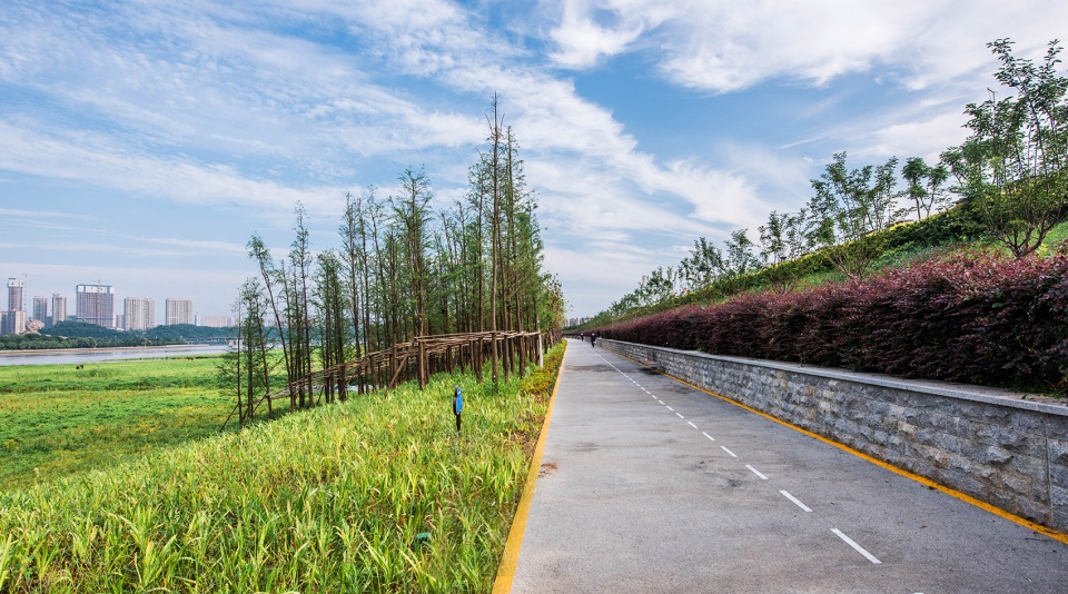
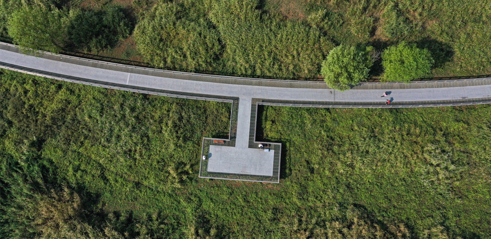
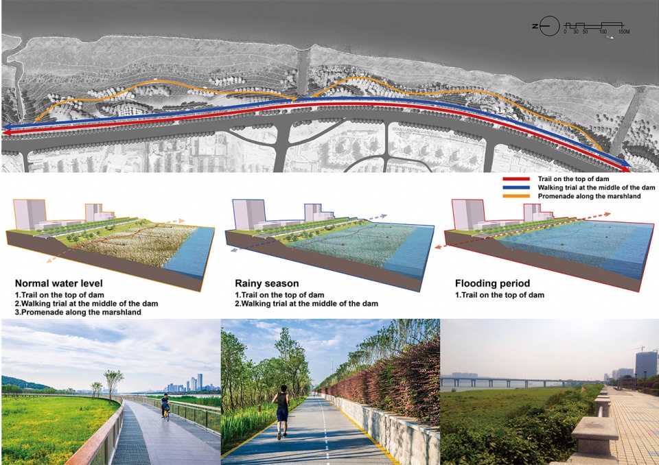
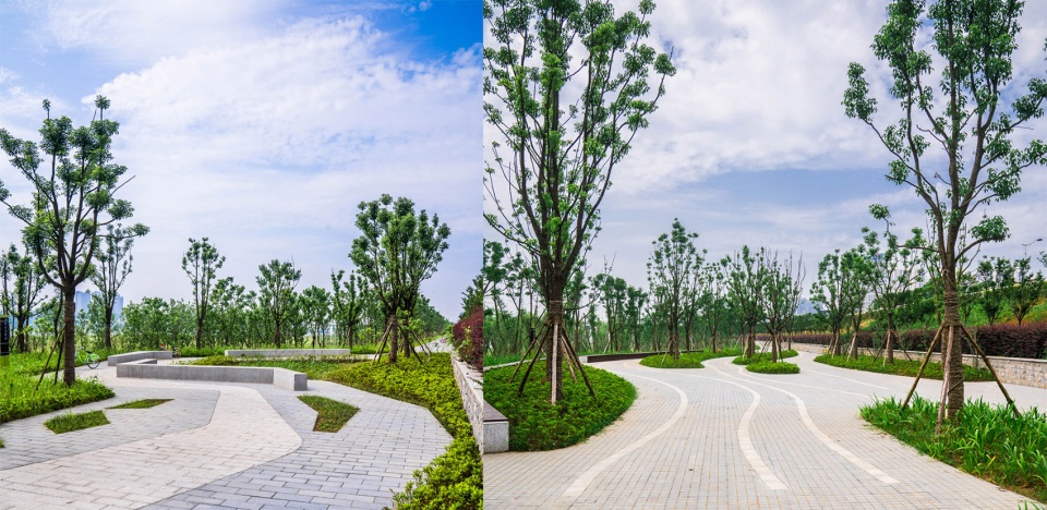
活动空间的分层设计最大限度满足市民活动需求:为适应不同水位的活动及观景功能,设计考虑了堤顶观光步道、堤腰综合慢行道、滩地悠游步道三种不同高程的步道系统。
Layered spaces were well designed for various leisure activities: three trails with different elevations were built to maximally meet the citizen’s requirements of leisure and viewing on different water levels. They are sightseeing trail on the top of dam, the multi-functional trial in the middle, and the promenade along the marshland.
▼为适应不同水位的活动及观景功能,布置了三种不同高程的步道系统,Three trails with different elevations are built to meet the citizen’s requirements of activities and viewing on different water levels ©奥雅设计
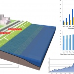
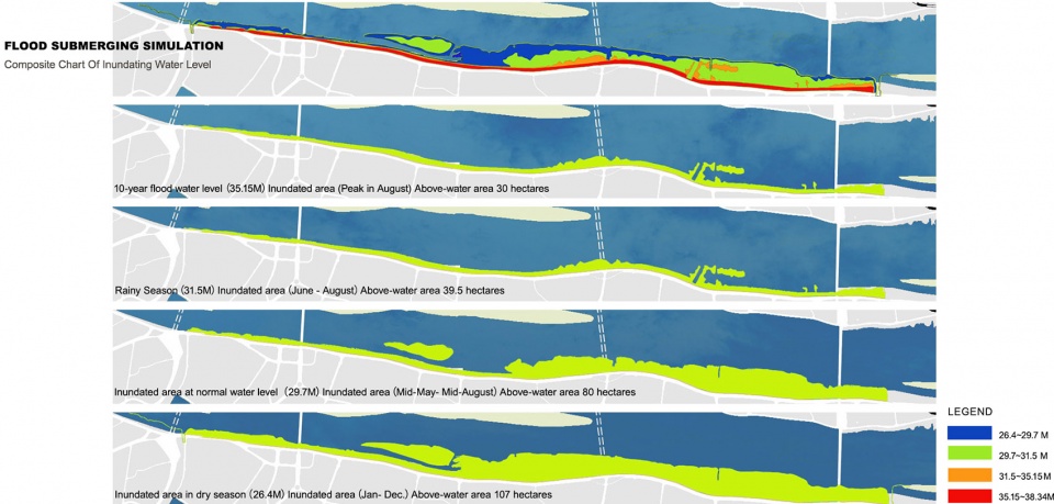
▼ 设计师用软件模拟了在不同水位场地的淹没情况,Related software was adopted to simulate the flooding at different water levels ©奥雅设计
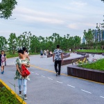
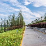
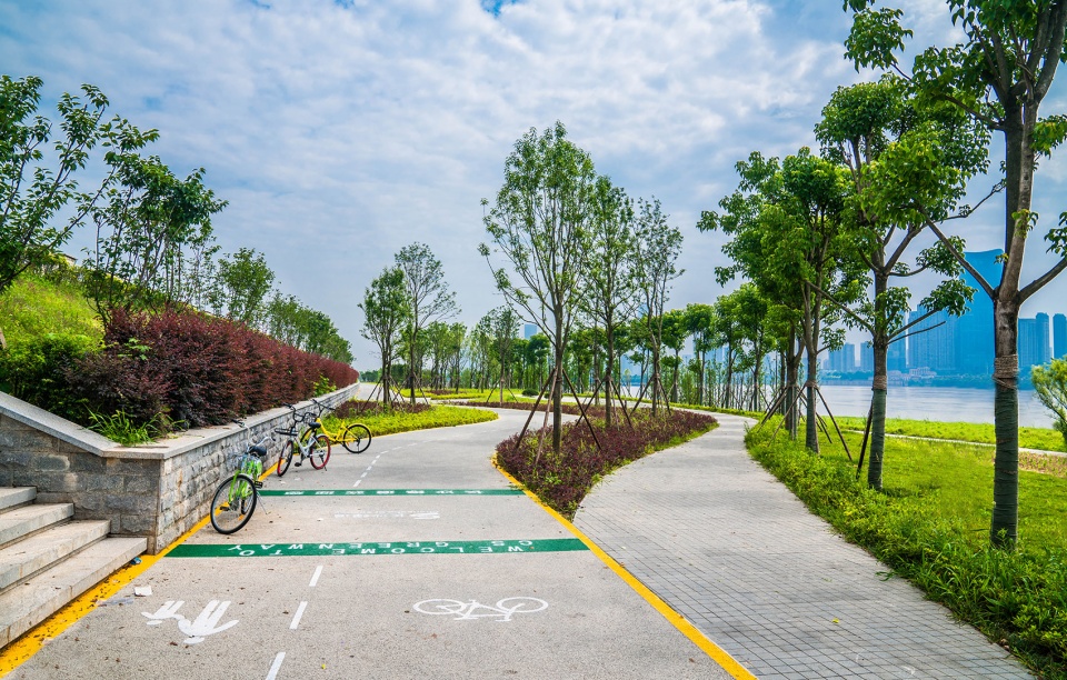
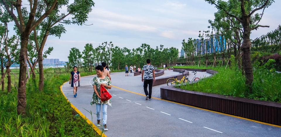
公园的出入口位于堤顶,间距700-1000米布置,主入口的布置与潇湘大道人行过街设施位置相结合,保证可达性,增加城市与自然的链接度。堤腰路位于丰水期水位线以上,设计团队将现状道路改造为自行车和步行混行通道,增设座椅、廊架等休憩设施。
The entrance and exit of the park were built at the top of the dam, with spacing of 700 to 1000 meters. The main entrance was connected with the pedestrian crossing facilities of Xiaoxiang Avenue to ensure its accessibility, and to strengthen the connection between city and nature. Above the flood water level, the existed road system in the middle of the dam was reconstructed as a double-functional passage both for bicycle riders and pedestrians. Additional leisure facilities were also set along the passage, such as seats and pergolas.
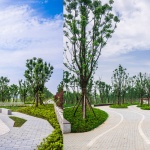
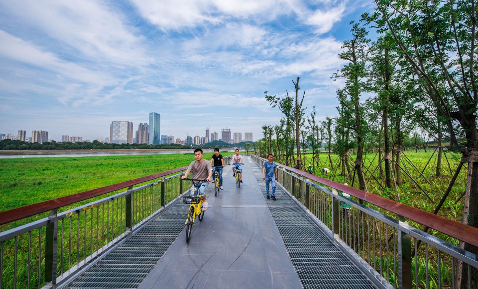
▼ 自行车和步行混行通道,double-functional passage both for bicycle riders and pedestrians ©林涛
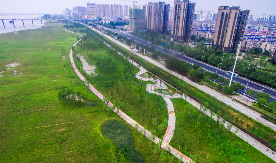
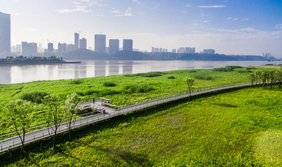
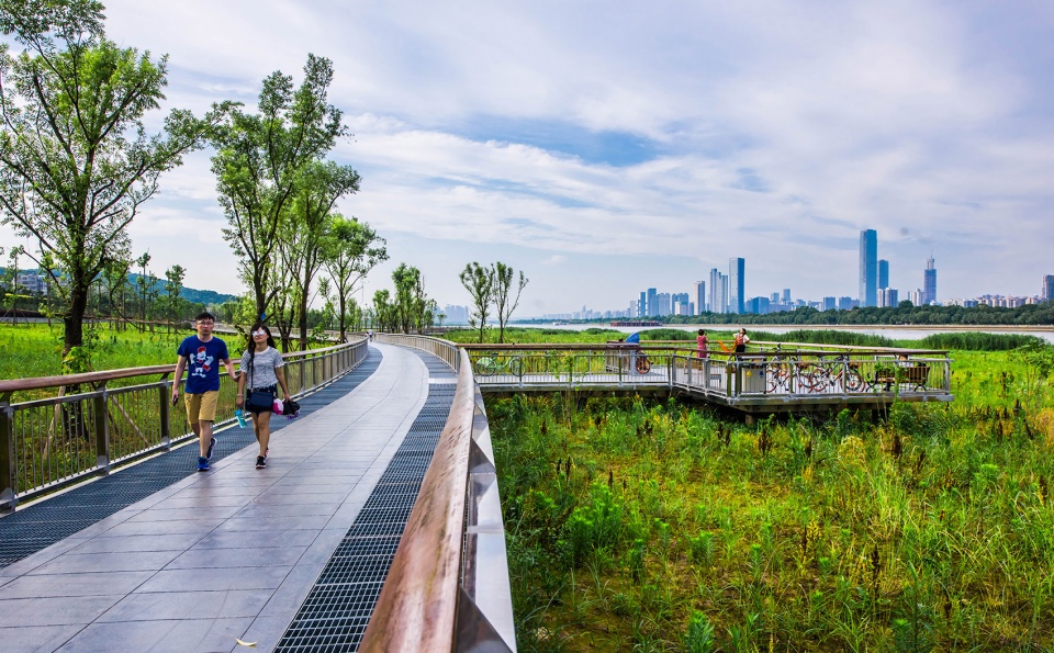
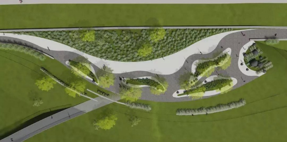
在地势较平坦的场地设计了五个活动空间,保证丰水期大面积被淹没的情况下仍旧可以保证市民活动需求,实现城市开放空间的价值。滩地栈道位于常水位线以上,途中延伸出少量观景平台,引导人们以最近的距离感受自然的魅力,“无座位”设计可以缩短人的停留时间,以减小其行为对生态的干扰。
Five activity grounds were built on the relatively flat land to maximize the value of this urban open space even during the flood season. The plank path on the beach was built above the regular water level line. There are several “no-seat” viewing platforms stretched out of the path to encourage people to approach the beautiful nature but without staying, so as to minimize the interference to the ecology.
▼ 滩地栈道位于常水位线以上,途中延伸出少量观景平台,plank path on the beach was built above the regular water level line, there are several “no-seat” viewing platforms stretched out ©林涛
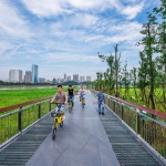
▼ 游客在栈道上骑行,tourists ride on the plank road ©林涛
城市效益的激发
Social Benefit Stimulation
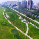
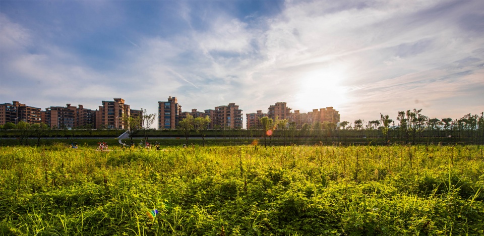
江滩公园建成后,让长达40余公里的湘江风光带长沙城区段建设画上圆满句号。有关监控数据表明,湘江风光带长沙城区段目前每天至少10万人出入,成为长沙最大城市绿色公共空间。
江滩公园使“荒地”变“绿洲”,消除了附近居民对生态环境的破坏行为,为游客提供了更健康的与自然亲近的方式。
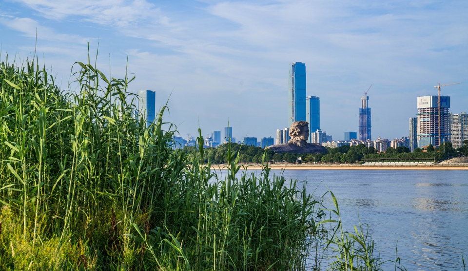
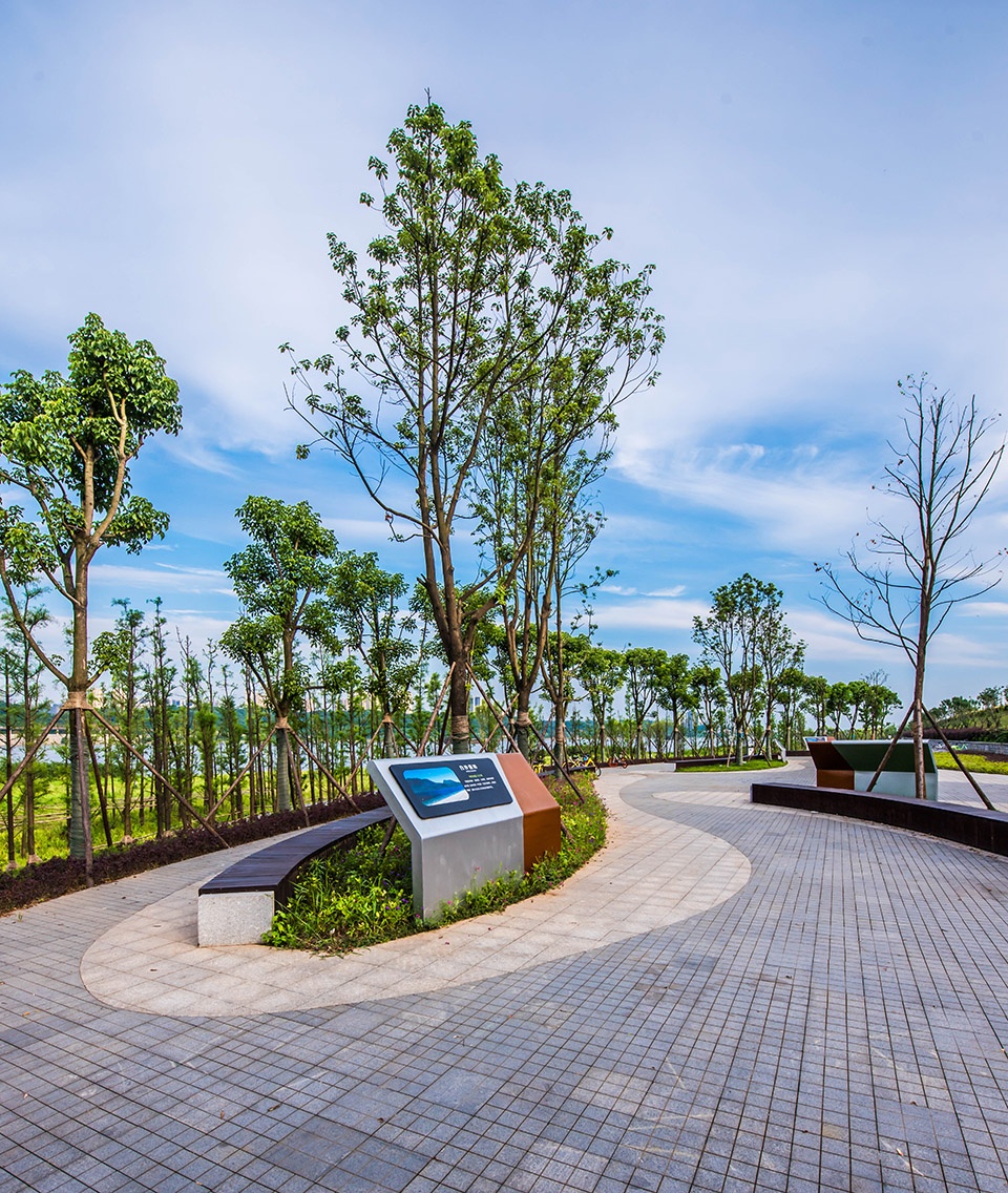
一城一味,江滩公园的湘文化调动着每一位游人的归属感。设计借用了长沙重要历史文物竹简作为景观构筑物的原型,并用现代的设计手法打造了“白沙江滩”的景观风貌,具象了长久以来人们对长沙城的记忆。
This project which is the largest urban public green space in Changsharepresented the completion of Xiangjiang River Scenic Belt in the city section with more than 40 kilometers. Relevant monitoring data indicated there are at least 100,000 people visiting this Section per day.
This project successfully changed the “wasteland” into an “oasis”, eliminating the destruction to the ecological environment by nearby residents and providing visitors with a healthier approach to the nature.
Always, a city processes its own native flavor. In this project, native culture inherent in the marshland park is the right flavor delivering the sense of belonging to its visitors. Bamboo slips, as one of the significant historical cultural relics in Changsha, was brought to be a key design element to create a traditional ancient image of Changsha by modern design techniques.
▼ 江滩公园使“荒地”变“绿洲”, changed the “wasteland” into an “oasis” ©林涛
湘江的水文形态则是以景观肌理的形式贯穿在活动空间中,湘江蜿蜒曲折的形态、波浪的动感、水面的纹理使江滩公园与环境融为一体,强化了湘江的地域特征;底蕴深厚的麓山文化在湖湘文化中占据重要位置,设计团队将其以图文形式融于景观,与文化景观构筑物进行结合,相得益彰,用最直接的方式进行文化传输,使游人在快节奏的城市里放慢脚步,品读独属于这里的精神与气质。
▼ 小广场平面,Square plan ©奥雅设计
▼ 广场上图文形式的文化输出,cultural impression in graphic form on the square ©林涛
The public spaces in the park are well connected by the hydrological form of Xiangjiang River with landscape texture integrated. An ideal interaction is achieved between the park and its surrounding dynamic riverscape. The profound Lushan Culture occupies an important position in Hunan province. The design team integrated it into the landscape in the form of graphics and texts, combining with the cultural landscape structures to complement each other by the most direct way for cultural transmission. The visitors enjoy the unique local culture and spirit, slowing down and staying away from the fast-paced city life.
▼ 设计语言中采用了大量的波浪和弧线,a lot of arcs are used in the design language ©林涛
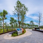
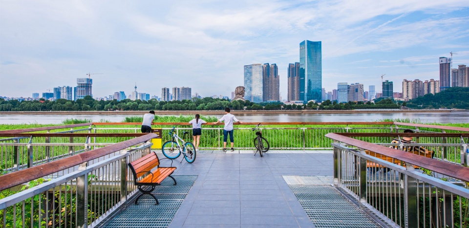
平日的傍晚或是周末的午后,走进与高楼大厦一路之隔的江滩公园,置身大自然享受闲暇时光。公园里随处可见市民散步、骑行、休憩观光的身影,树影交织之下,或随便在堤腰路上走一走,或在小广场停下来和熟人寒暄。
It is a nice choice to spend leisure time in this green park adjacent to high-rise buildings, strolling, cycling, and leisurely sightseeing and appreciating the intertwined sunlight and shadow. Some people are wandering along the embankment, while others are having a rest on the small sunken square, chatting with acquaintances and watching the river scenery.
▼ 游客在小广场上放松休闲,tourists relax on the square ©林涛
再往下走几步台阶,江面便铺在眼前,滩地栈道更是拉近了人与自然的距离,行走在江面、漫步在绿丛,人们纷纷在观景平台驻足,西望岳麓山,东观橘子洲头,在景区的拼图里,聆听百鸟争鸣,欣赏隔岸风景。
或许不是每个人都有机会俯瞰这片江滩,但只要走进去,你已经置身于自然。
The plank path on the marshland acts as a friendly bridge between people and nature, attracting visitors to walk along the well-planting river beach. Visitors are immersed in the landscape on the viewing platform and nestle in this jigsaw puzzle of nature.
Not everyone may have a chance to overlook the beach, but as long as you go inside, you are already in nature.
▼ 黄昏的江滩,Early Eveningview of Marshland ©林涛
项目名称:长沙湘江西岸江滩提质工程
项目地点:湖南省长沙湘江西岸江滩
项目类型:城市公共空间 滨水空间
景观设计:奥雅设计
景观面积:80公顷
设计时间:2015年
客户单位:湖南湘江新区市政设施建设有限公司
编辑: Christine
摄影:林涛
Project name:Changsha Xiangjiang River West Bank Marshland Improvement
Project location: The bank of Xiangjiang River on the west bank of Changsha, Hunan Province
Project type: Urban public space Waterfront space
Landscape design: L&A Design
Landscape area: 80 ha
Design year: 2015
Client name:Hunan Xiangjiang New District Municipal Facilities Construction Co. LTD
Editor:Christine
Photographer: Lintao
More: L&A Design 更多关于:L&A Design on gooood